This site uses technical, analytics, and third-party cookies.
By continuing to browse, you accept the use of cookies.

SMINO

Welcome to the website of the Monitoring System of North-Eastern Italy

SMINO, the seismic and geodetic monitoring system of north-eastern Italy, is made up of a seismometric network, a ground motion network and a geodetic monitoring network (FReDNet). It is a national infrastructure (PNIR 2021-2027) and contributes to the fulfillment of the institutional task of the CRS, which, as provided by law 399/1989, has responsibilities for monitoring and researching seismic activity in North-Eastern Italy, also for Civil Protection purposes.

SMINO operates in close cooperation with national and international networks of neighboring countries under framework agreements for real-time data exchange. Information regarding seismic events is disseminated to the public through a dedicated web portal. Seismic bulletins reporting information about earthquakes recorded in North-Eastern Italy are published regularly.


SMINO Networks

La rete sismometrica

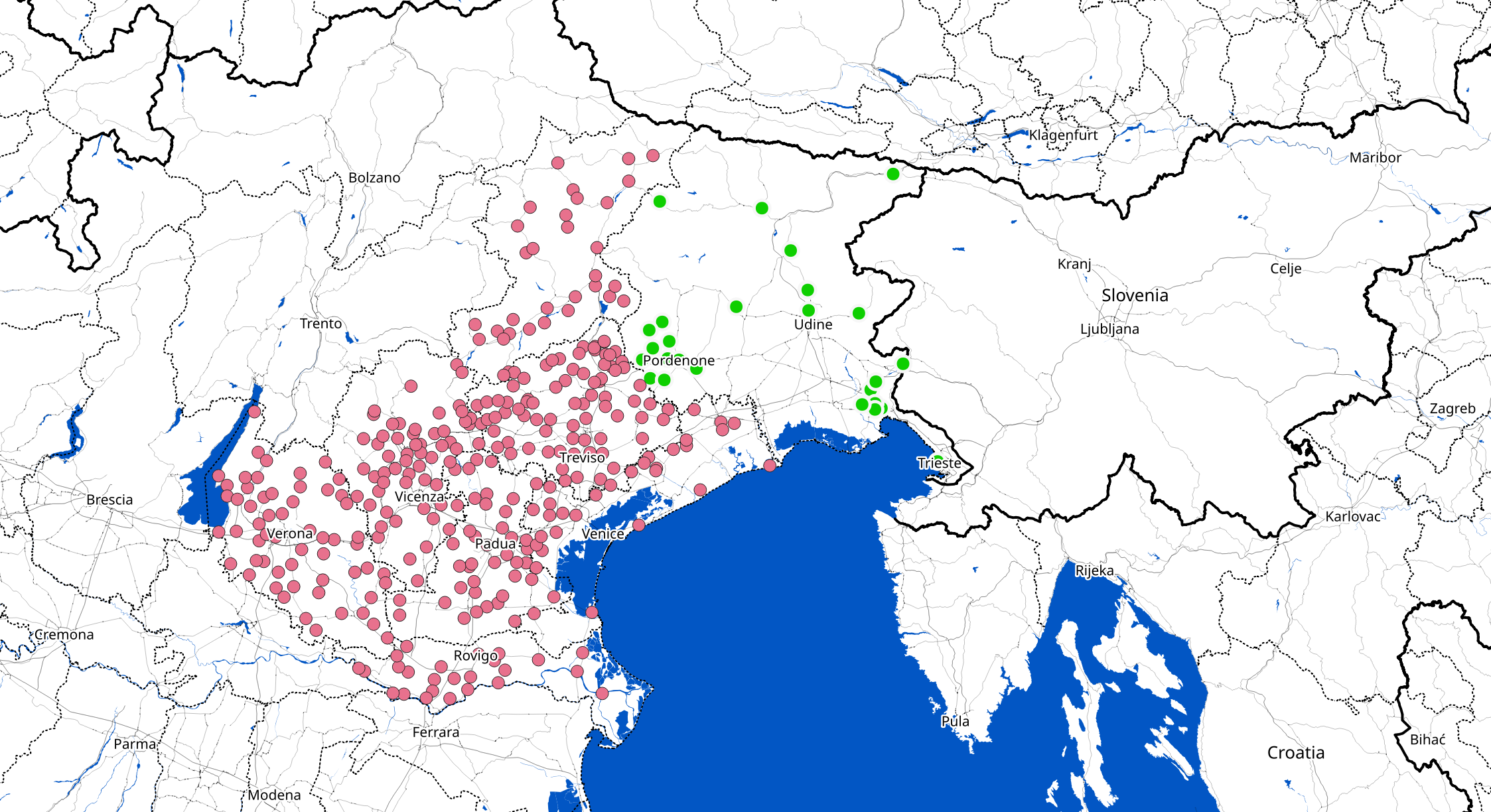
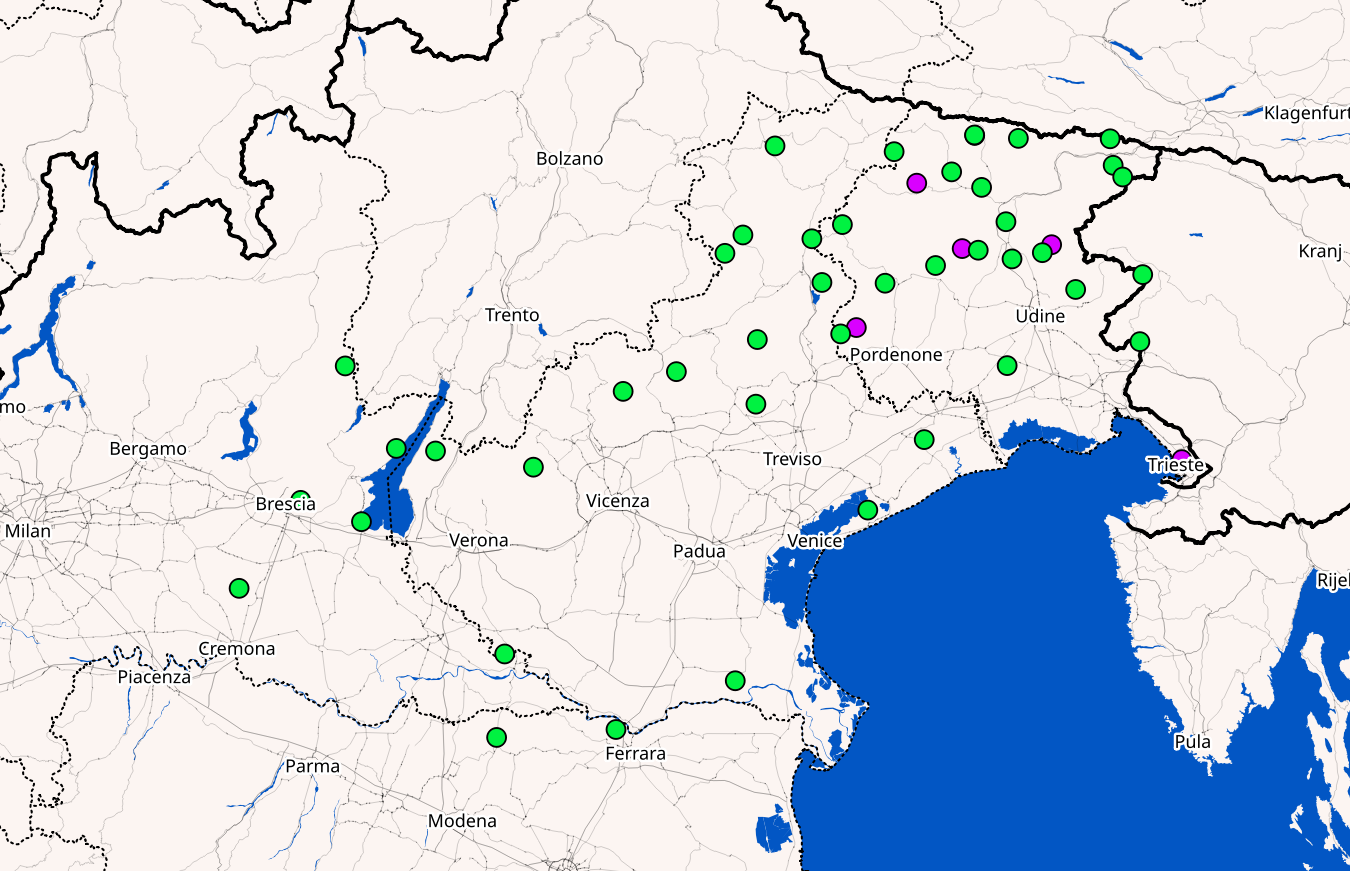
Seismometric Network

The seismometric network of North-Eastern Italy, managed by OGS, includes 43 stations that monitor earthquakes in real time. The data is shared with the national seismic system and with networks from neighboring countries, and it is part of the cross-border CE3RN network, fostering international collaboration.

Read more
La rete Geodetica

Geodetic Network

FReDNet is a network of 22 GNSS receivers to monitor crustal deformations in Friuli Venezia Giulia, developed since 2002. It provides a real-time georeferenced navigation service and is integrated with other national and European geodetic networks.

read more
La rete Accelerometrica Diffusa

Widespread Accelerometric Network

The Veneto Region has tasked OGS with implementing a network of 300 accelerometers to monitor seismic activity, quickly assess damage, and enhance prevention efforts. The project includes the study of local effects, building characteristics, and deepening knowledge about crustal deformation and the role of groundwater in earthquakes.

Read more
La rete Fibra

Fiber Network

The ITINERIS project integrates DAS (Distributed Acoustic Sensing) technology into the seismic monitoring system of North-Eastern Italy. By using optical fibers, this innovation will enhance the detection of earthquakes and ground deformations, improving the Civil Protection's capacity to respond to natural hazards.

Read more
La rete Gravimetrica

Gravimetric Network

The Regional Gravimetric Network, developed by OGS, will monitor variations in gravity in North-Eastern Italy with relative measurement points and absolute benchmarks. It will contribute to local geoid mapping, subsurface exploration, and the monitoring of tectonic structures and aquifers, integrating data with other geophysical networks.

Read more

Projects

Agreement with the Friuli Venezia Giulia Civil Protection Agency

Two fundamental laws govern the collaboration between OGS, particularly the CRS, and the Friuli Venezia Giulia Civil Protection Agency, defining their role in seismic monitoring for civil protection purposes. The agreements have developed a protocol for timely communication during earthquakes, ensuring continuous improvement of the seismometric and accelerometric network, as well as training for Civil Protection volunteers. OGS and the Civil Protection Agency have also collaborated on European projects like Hareia and Armonia to extend the accelerometric network and monitor earthquake impacts on structures. Read more

Agreement with the Veneto Civil Protection Agency

Agreements with the Veneto Civil Protection Agency began in the 1990s, leading to the development of a protocol that regulates the timing and methods by which CRS communicates essential information to the Civil Protection during seismic events above a certain threshold, enabling swift intervention coordination. These agreements ensure the proper functioning and continuous improvement of the seismometric and accelerometric network, as well as ongoing research to better understand seismic events and their impact on the territory. In addition to regular activities, OGS and the Regional Civil Protection Agency have collaborated on European projects such as Armonia and Venet-ONE to monitor the effects of earthquakes on buildings. Read more

PNRR Projects and SMINO

SMINO, part of the National Recovery and Resilience Plan (PNRR) ITINERIS, is a national research infrastructure aimed at developing interdisciplinary research in environmental sciences. It coordinates 22 infrastructure nodes to address scientific and social issues by utilizing existing data and new observations. The project also includes the modernization of the fiber optic network, the calibration center, and the extension of the seismic network. Other PNRR projects, such as GeoSciences IR, MEET, and RETURN, contribute to improving geological research, monitoring natural hazards, and enhancing community resilience. Read more

Our partners:

  • Protezione Civile Veneto
  • UniTS
  • UniLJ
  • UniZB
  • Harphasea
  • Austria
  • Arso
  • ETH
  • INGV
  • Protezione civile fvg